
Most borders are something you cross on the way somewhere else. These six places are different: the border is part of what makes the destination itself legible.
Sometimes it divides one historic city into two. Sometimes it runs through a shop floor. Sometimes it disappears into a lake or becomes a river canyon. The point is not to collect countries faster. It is to notice how geography, history and daily life change when one place belongs to more than one national story.
Prespa Lakes · Where the border disappears into the landscape
Explore destination →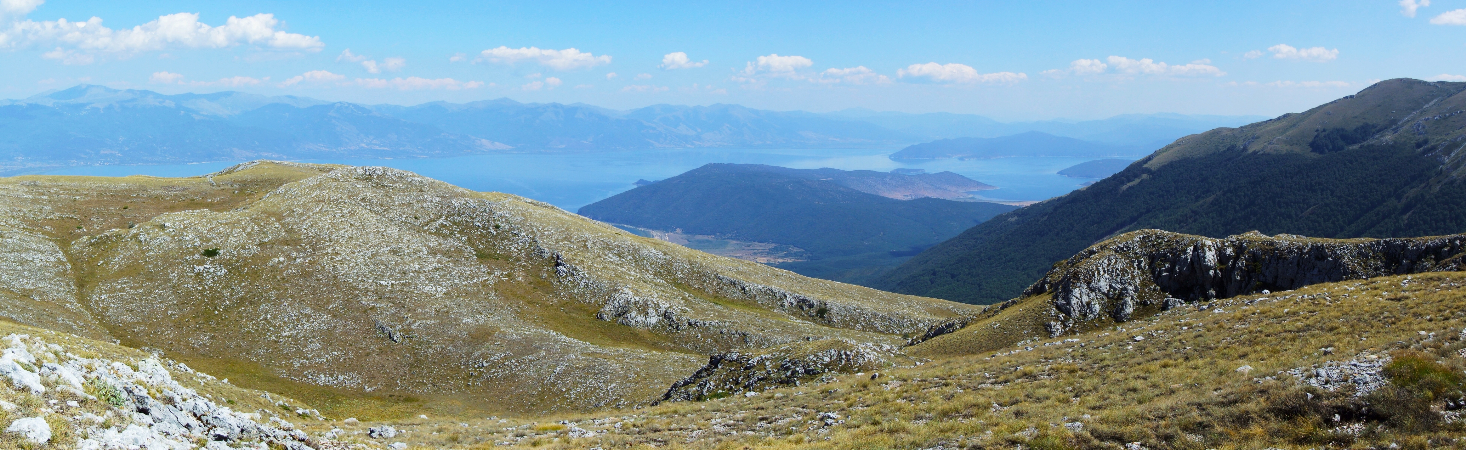
Prespa is the most natural expression of the idea. Great Prespa is shared by Albania, North Macedonia and Greece; around it, mountains, wetlands, islands and villages form one coherent basin even though the roads and institutions belong to three countries.
The border matters when you plan the Journey, but it should not dominate it. OREVYON would choose one base and cross only when the other side genuinely changes the experience — Greek wetlands, North Macedonian mountain villages or Albania's quieter shore and Maligrad.
landscape shared by three countries.
nature, slow self-drive and multi-day depth.
never turn Prespa into a three-country speed run.
Gorizia / Nova Gorica · One square, two cities
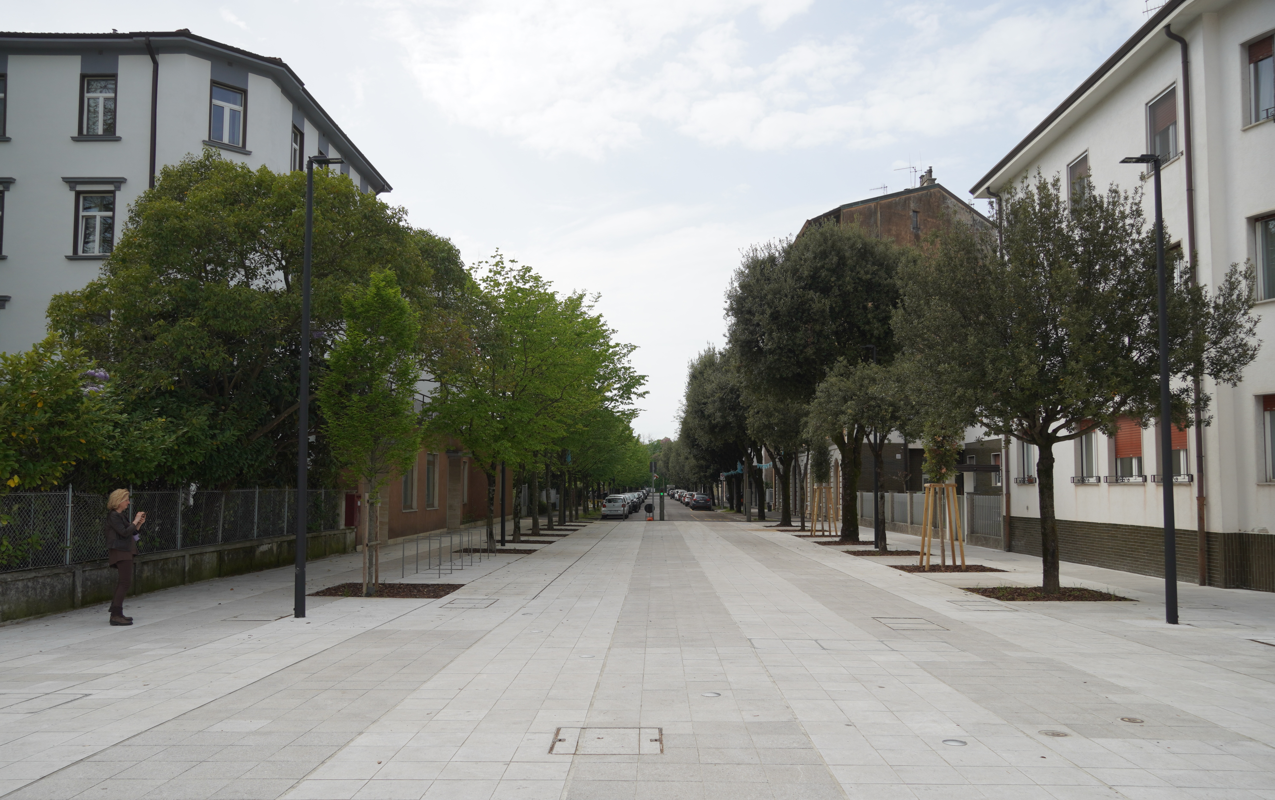
Few European borders are as visually clear and emotionally reversed as this one. After World War II, Gorizia remained in Italy while a new city, Nova Gorica, developed on the Yugoslav side. Piazza Transalpina sat on the divide; the fence was removed when Slovenia joined the European Union in 2004.
Today the same square is shared space. The two cities jointly held the European Capital of Culture title in 2025, and a cross-border audio route continues through 2026–27. Here the border is not an oddity added to the city — it is the key to reading the city.
one urban fabric rebuilt as two cities.
20th-century history, architecture and walking.
Stay long enough to compare the Habsburg texture of Gorizia with the planned modernism of Nova Gorica.
Valga / Valka · The twin town that changes language mid-walk
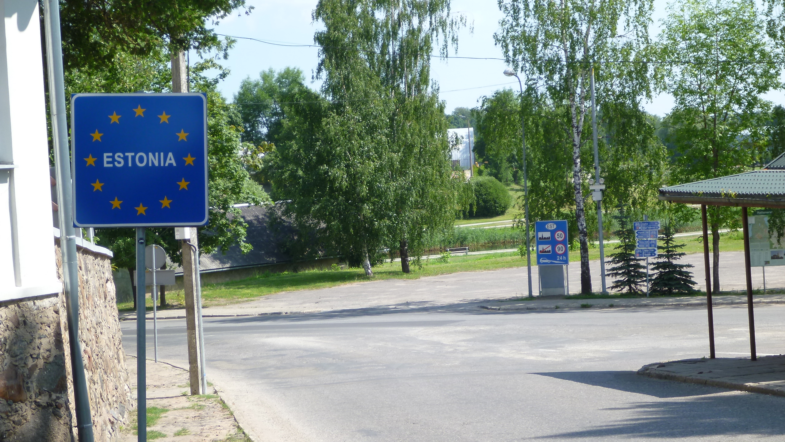
Valga in Estonia and Valka in Latvia were once one town. Today they remain neighbours with a shared history but different languages, administrations and national identities.
This is not a blockbuster destination, and that is part of its value. On a Baltic road or rail journey, Valga/Valka turns the abstract idea of Schengen-era Europe into something domestic: the border appears in parks, streets and everyday errands rather than monumental architecture.
historic town divided into twin towns.
Baltic road trips, rail travellers and understated urban history.
a strong stop, not necessarily a destination that needs three nights.
Cieszyn / Český Těšín · A river turned one town into two
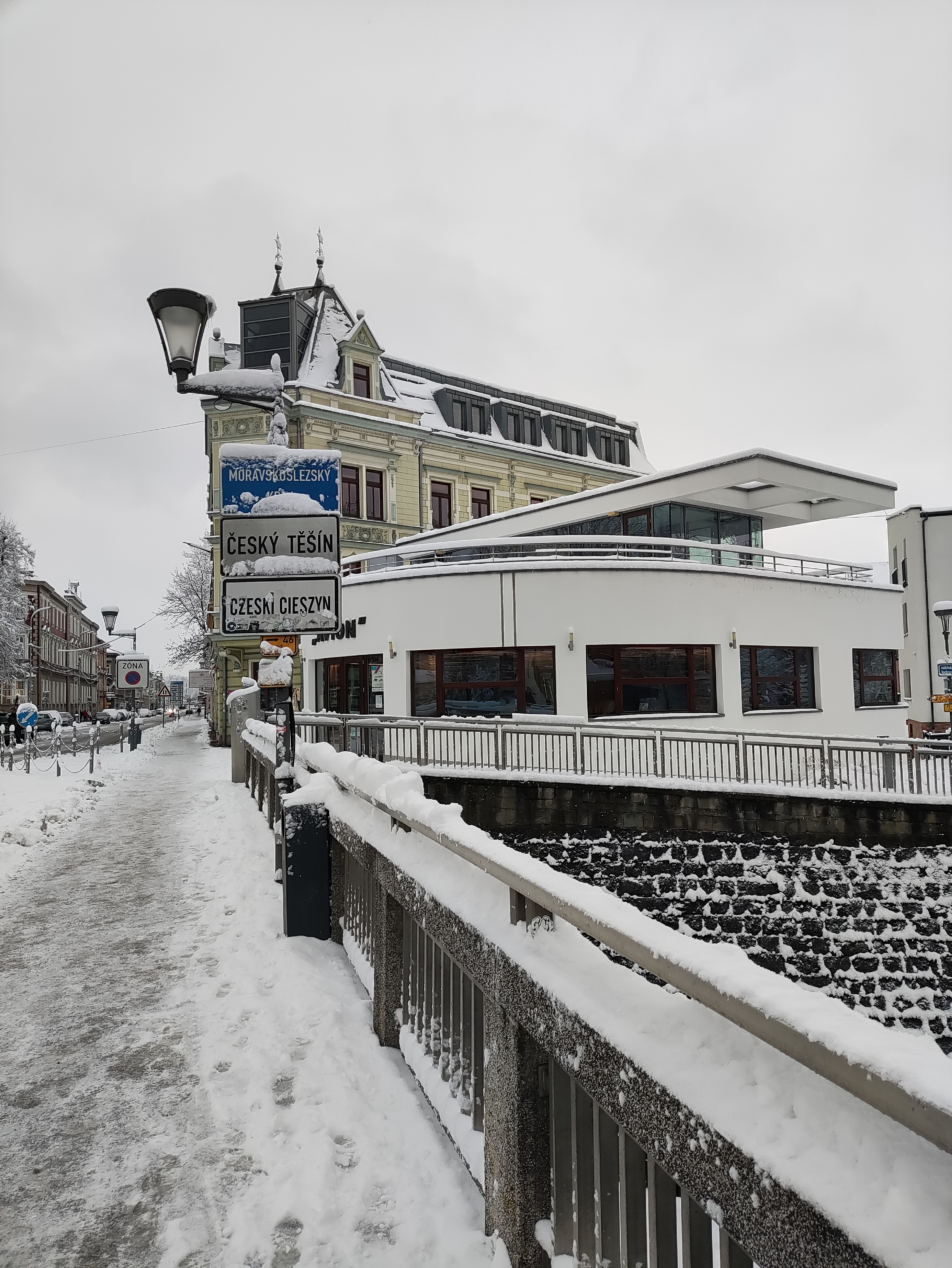
Cieszyn developed for centuries as one town in Silesia. In 1920, the settlement was divided along the Olza River; the western bank became Český Těšín in Czechoslovakia while the historic core remained Cieszyn in Poland.
The Friendship Bridge now makes the division easy to cross on foot. What is interesting is not simply standing in two countries, but noticing how two urban centres grew differently after the split while continuing to face one another across a narrow river.
one historic city divided by a river.
compact walking, Central European history and urban contrast.
Pair the bridge with the historic centre rather than treating the border as a photo stop.
Baarle-Hertog / Baarle-Nassau · When the border enters the building
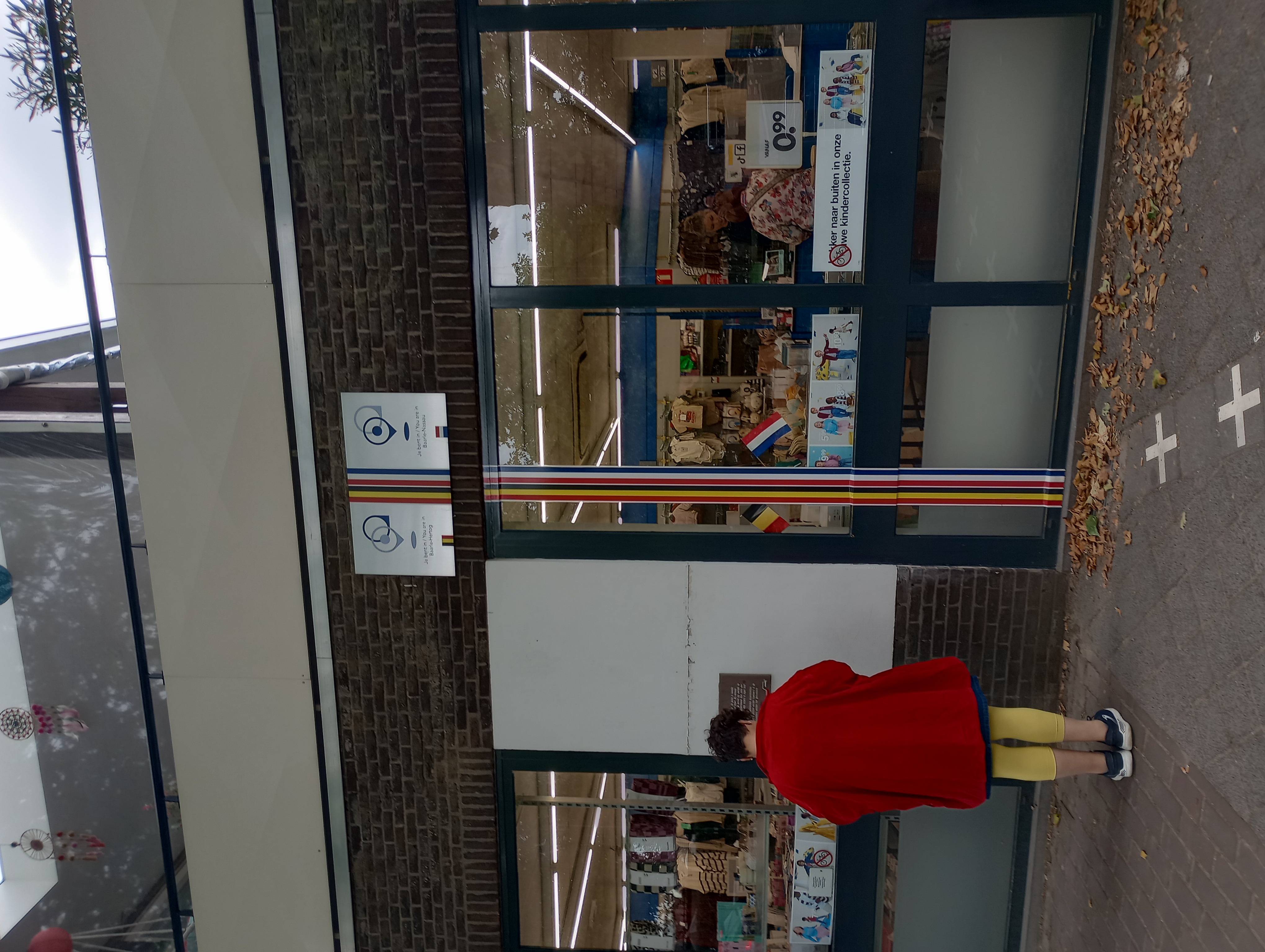
Baarle takes the idea to its most literal extreme. The village contains 30 enclaves: 22 Belgian pieces of Baarle-Hertog and 8 Dutch enclaves of Baarle-Nassau, some of them counter-enclaves inside Belgian territory.
The boundary is marked across pavements, streets, houses and shops. This is geography at human scale: your front door can decide which country an address belongs to. Visit Baarle's enclave walk turns the puzzle into a four-kilometre route through the village centre.
enclaves and counter-enclaves woven through one village.
geographic curiosity, walking and a highly unusual half-day stop.
Do not rush only between markers; the fascination is that normal village life continues around them.
Douro Internacional · When the border becomes a canyon
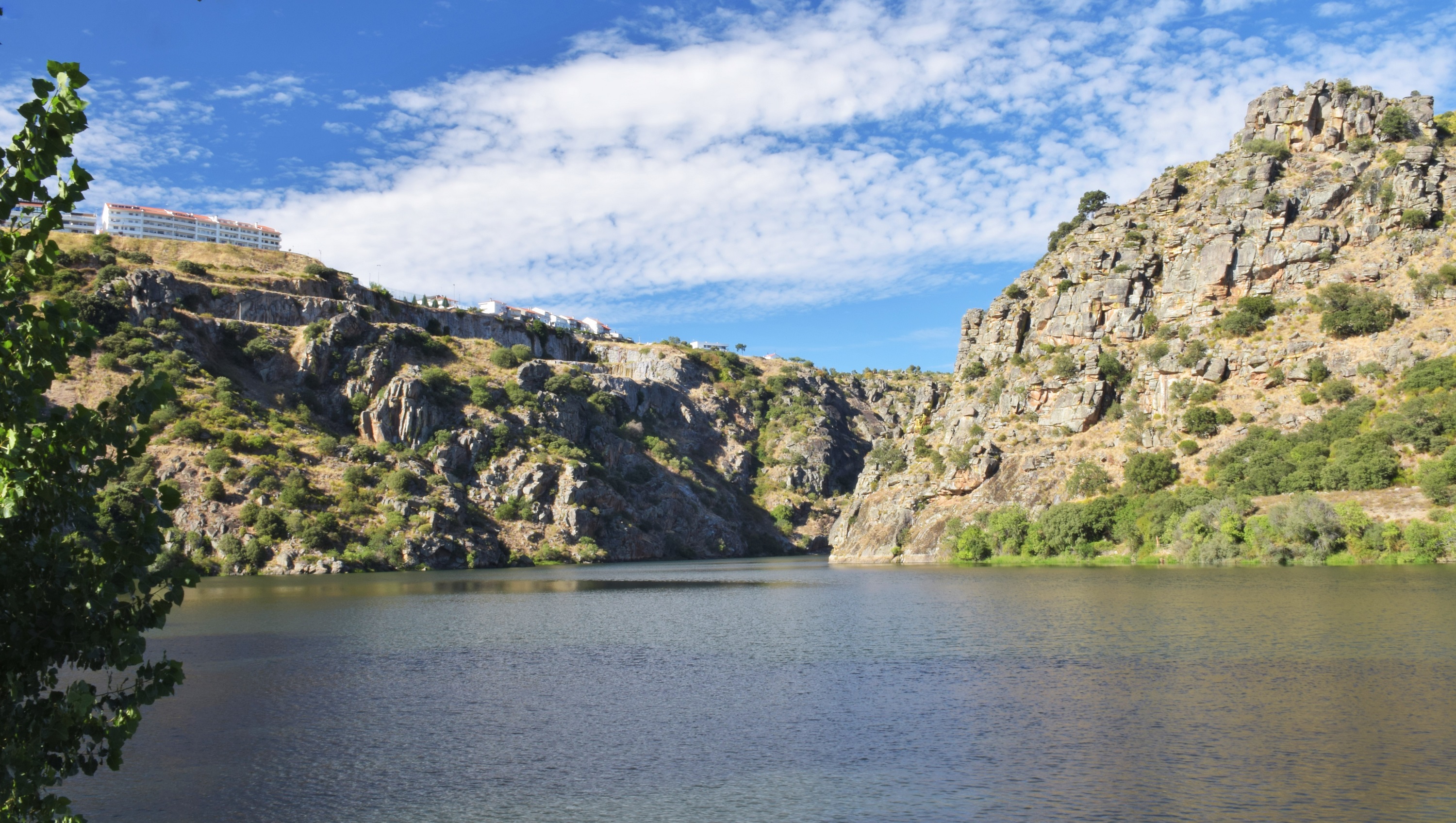
Along roughly 122 kilometres, the Douro forms the frontier between Portugal and Spain through a landscape of steep ravines, exposed rock and important bird habitat.
Here the border is almost invisible because the river does the work. Miranda do Douro provides a practical Portuguese base, but the deeper travel idea is the frontier landscape itself: viewpoints, river journeys and long horizons where political geography follows geology.
river frontier and protected landscape.
nature, road trips, birdlife and wide-open scenery.
the strongest counterpoint to the urban borders elsewhere in this collection.
The OREVYON read
The best border destinations are not interesting because you can stand in two countries at once.
They are interesting because the line has changed the place around it. Prespa makes one landscape feel shared. Gorizia and Nova Gorica turn division into urban memory. Valga and Valka make two languages part of one walk. Cieszyn shows how one town evolved twice. Baarle turns sovereignty into domestic geometry. The Douro lets geology draw the frontier.
That is the collection: not borders as barriers, and not borders as novelty — but borders as one more layer through which a place can be understood.